Runways
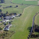
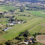
- GRASS 830 x 22 m - 2T MTOW
- RWY 11 QFU 105° TORA = 760 m LDA = 680 m
- RWY 29 QFU 285° TORA = 720 m LDA = 680 m
Obstacles
- Power line 800m W of TRH RWY 11: Height 131 ft (40 m) AGL
Circuit
- Altitude: 800ft, remaining south of the airport
- RWY 11: Right-hand, 800 ft
- RWY 29: Left-hand, 800 ft
Radio
- Amougies Radio on 119.755
- PPR mandatory on +32.69.45.55.30
Operation hours
- From monday to sunday from 10.00LT to 19.00LT
- Last take-off at 18.30 LT
Fuel
- UL91: on request
Bar / Restaurant
- Open on Mondays, Fridays and weekends
Weather
- AIS - METEO Brussels-National Tel. +32.27.53.65.45
- Meteo europe: Taf en Metar
Varia
- Taxi slow and only on taxiways
- Overflying Kluisberg (North of the airfield ) is prohibited under 2500ft AGL
- Avoid villages (Amougies, Orroir, Celles, Escanaffles, Russignies, Anseroeil)
- Watch out for ULM activity
"ATTENTION FOREIGN VISITORS: Please be reminded that it is the responsibility of each PILOT/OPERATOR visiting us to obtain and verify the necessary prior authorizations from the Belgium Civil Aviation Authoruty before crossing Belgian borders. JMB AVIATION and its insurer cannot be held liable for any breaches of Air Traffic Regulations in the event of an accident or violation."
"ATTENTION VISITEURS ETRANGERS : nous vous rappelons qu'il appartient à chaque PILOTE/ EXPLOITANT qui nous rend visite d'obtenir et vérifier les autorisations préalables auprès de l'Aviation Civile avant de franchir les frontières belges. JMB AVIATION ne saurait être tenu pour responsable des manquements aux Règles de l'Air en cas d'accident ou d'infraction."

